
Walk a Lawrence Street by Address
A street-by-street search works best as a chain. Marion County property tools identify a parcel and assessed owner, while deeds document transfers. City permits add work performed at the service address. Voter material has tighter access rules and should never be treated as an open block roster. Historical criss-cross volumes can associate a printed name with an address for a stated year, but they do not prove who lives there now.
- Standardize the address with the USPS lookup, then keep the returned city and ZIP as postal data, not proof of Lawrence city limits.
- Open MapIndy, select the parcel, and save its parcel number, boundary, situs address, and linked property card.
- Compare the owner and transfer rows on the assessor card, keeping the owner’s mailing address separate from the property situs.
- Search Recorder RMIS by GIS address, parcel PIN, party, and date to follow deeds and other instruments.
- Check Lawrence permit records and, for an older household, consult a dated Haines or Polk address section.
The stable key is usually the parcel or legal description. Street labels can shift, lots can split, and condo units may share a footprint. Preserve each source date so a past name is not presented as current.
Write down the exact address suggestion selected in the county system, including direction, street type, and unit. Then record whether the result shows a situs address, an owner's tax-mailing address, or both. Those labels answer different questions. If MapIndy places the point outside Lawrence's municipal boundary, keep the postal city and legal city separate. A ZIP or Indianapolis mailing label alone does not settle which city contains the parcel.
Search Lawrence Property Cards Four Ways
The Marion County Assessor Property Cards search accepts several routes into the same report. Address suggestions are useful when spelling is uncertain. Parcel keys are better when the street label has changed. Owner-name results can include similar names, so the street directory must confirm the selected parcel before using any owner field.
| Search mode | Input | Portal behavior | Check before use |
|---|---|---|---|
| Parcel Number | Seven-digit text | Exact parcel search | Match situs and legal description |
| State Parcel Number | Full 18-digit or hyphenated number | Exact state parcel search | Use when the alternate ID fails |
| Owner Name | All or part of a name | Returns name matches | Confirm address and parcel |
| Address | Text with suggestions | User selects a recognized address | Do not rely on a free-typed variant |
The resulting card may contain owner, situs, legal description, transfer history, values, improvements, a sketch, and a neighborhood code. That depth makes it a strong Lawrence address record, not proof of occupancy.
The assessor search screen shows the four entry modes used for Lawrence address work.
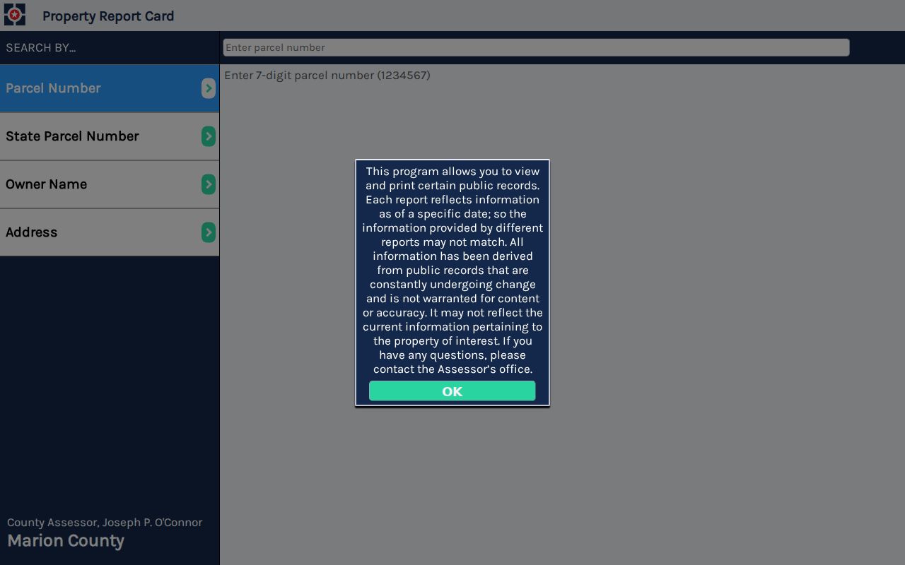
Its separate parcel, owner, and address choices help prevent a mailing address from being mistaken for the property being researched.
Map Lawrence Streets Parcel by Parcel
MapIndy turns one address into a visual street sweep. Search the address, zoom until parcel lines are clear, and select each lot in order. Record the parcel ID and map position in separate rows. For a long road, split the task by block or address range. A visible owner label is only a starting point; open the linked card for the full record.
The viewer offers parcels, building and unit addresses, city and town limits, ZIP boundaries, township lines, neighborhoods, police zones, footprints, and historic imagery. These layers answer different questions. An alley, creek, park, or shared tract can separate lots that look adjacent. The MapIndy help page explains address searches, selection, layers, measurement, and printing.
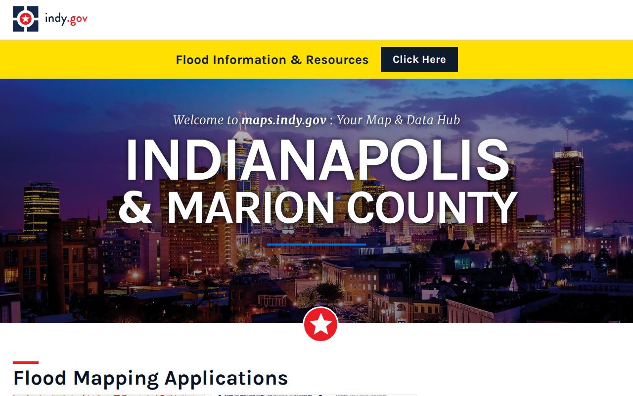
The parcel view supplies the spatial order needed to browse Lawrence by street without calling every nearby structure one property.
The address and layer instructions show how the same Lawrence street can be checked against several public map layers.
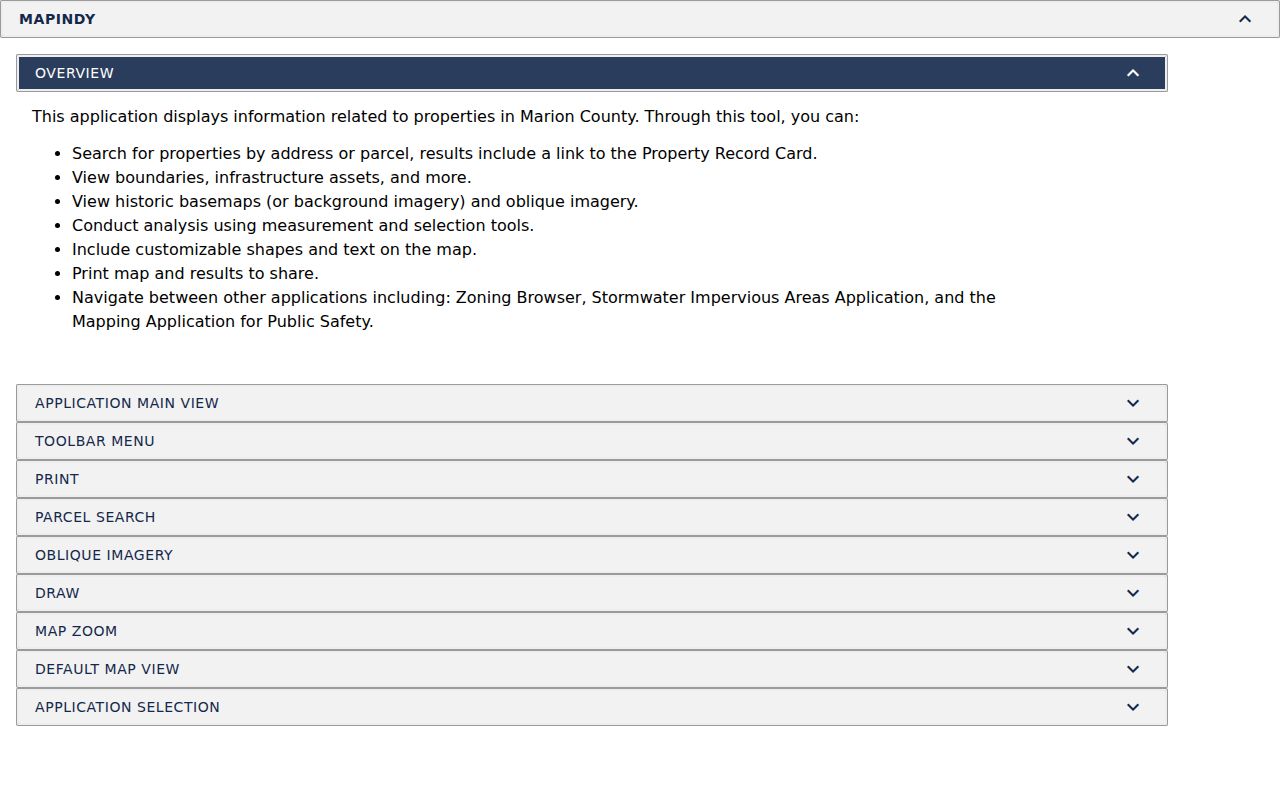
Those controls make a dated map print reproducible, especially when a street crosses a postal, township, or city boundary.
Lawrence Records Indexed by Street
No single Lawrence street directory lists every occupant. Instead, each address-keyed source contributes one part of the record. The parcel number links the assessor, map, tax, and deed work. The service address connects city permits. A publication year governs the historical directory evidence.
| Address record | Official keeper | Useful return | Access route |
|---|---|---|---|
| Property card | Marion County Assessor | Owner, situs, legal description, transfers | Free online card |
| Parcel map | IndyGIS | Lot lines, units, boundaries, nearby parcels | Free MapIndy viewer |
| Deeds and liens | Marion County Recorder | Parties, instrument, date, PIN, legal geography | Index, paid images, public terminal |
| Property cash history | Marion County | Tax-payment report by parcel and year | Online workflow |
| City permits | Lawrence Building Department | Permit number, type, service address | Tyler portal or records request |
| Old address directory | Libraries and archives | Dated name and address association | Online scan, microfilm, or research help |
If a portal fails, use the documented fallback chain. Recorder public terminals and staff phone help can identify instruments; city legal accepts a focused APRA request; libraries bridge older gaps with directories, Sanborn maps, clippings, and deed resources.
Lawrence Situs and Mailing Addresses
An assessor card can place several kinds of facts in one report: owner mailing address, property situs, legal description, transfers, assessments, improvement data, and a building sketch. Situs means the physical location of the parcel. The tax mailing address is where notices go. The two can differ, and neither field alone identifies every person who uses the property.
- Parcel
- A mapped tract with its own county identifier.
- Situs address
- The physical street address assigned to the parcel.
- Plat
- A recorded map that divides land into lots, blocks, streets, or easements.
- Criss-cross directory
- A directory arranged by street address, allowing a dated address-to-name search.
This distinction is the key insider tip for a Lawrence street directory. A rich property card tells a property story, but occupancy needs separate and lawful evidence.
Follow Lawrence Deeds Along a Street
The Marion County Recorder RMIS index accepts a full GIS address as well as party, instrument, date, subdivision, parcel PIN, and section-township-range fields. Start with the current parcel and legal description. Then compare assessor transfers with recorded instruments. Grantor means the party transferring an interest; grantee means the party receiving it.
Deeds should be separated from mortgages, releases, liens, and assignments. Those documents can name parties tied to the parcel without conveying ownership. Capture the document number or book and page, recording date, instrument type, party role, and image status. Remote images or printing may require payment or a public subscription, while a public terminal is the fallback. The current RMIS screen does not state one complete online cutoff year.
The RMIS deed index exposes the address and instrument controls used to move backward along a Lawrence street.
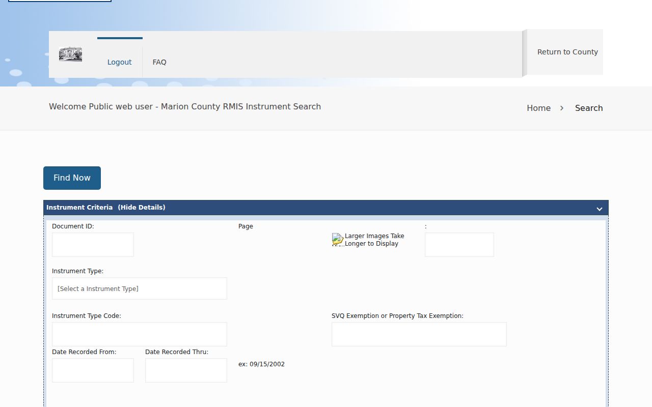
Its legal and parcel fields can keep the chain intact when the street number or mailing label changes.
Read Lawrence Permits by Service Address
The Lawrence Tyler permit search offers Permit Type, Permit Number, and Service Address. The Building Department also describes use of a seven-digit alternate ID and a full parcel ID when that shortcut fails. Permit coverage dates and the full permit-type list were not exposed during research, so they should not be guessed.
A permit can establish that work was proposed, inspected, or completed at an address. It does not establish who lived there. When no result appears, request a specific permit, inspection, or code file through Lawrence City Legal. Name the department, full address, parcel if known, record type, date range, and preferred electronic format. The city also provides a fillable PDF and says fees are arranged before delivery.
The permit interface keeps the service address distinct from a permit number or type.
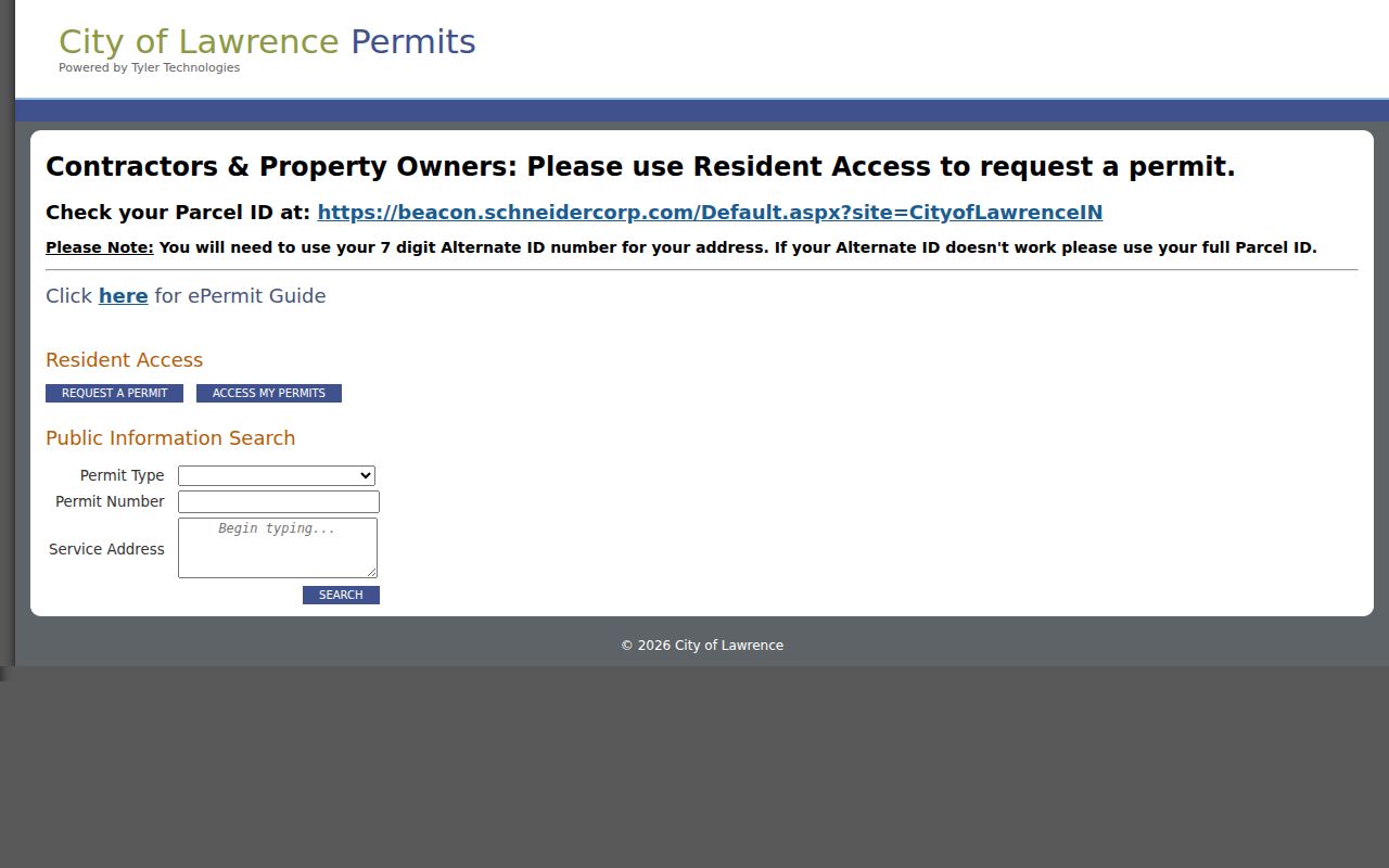
That separation lets a street search remain precise even when the exact permit class is unknown.
Check Lawrence Parcel Cash History
The property cash-history report searches by address, confirms a parcel and owner through autocomplete, and then applies a tax year. Taxes are paid in arrears, and a multiunit address may not appear as a separate unit. The report adds a payment layer to the street record without naming occupants.
Use cash history after the parcel has been confirmed, not as the first match. A similar address or unit omission can point to the wrong account. Save the tax year beside the report date and do not convert a payment event into a claim about residence.
The Marion County cash-history workflow shows how address, parcel, owner, and year work together.
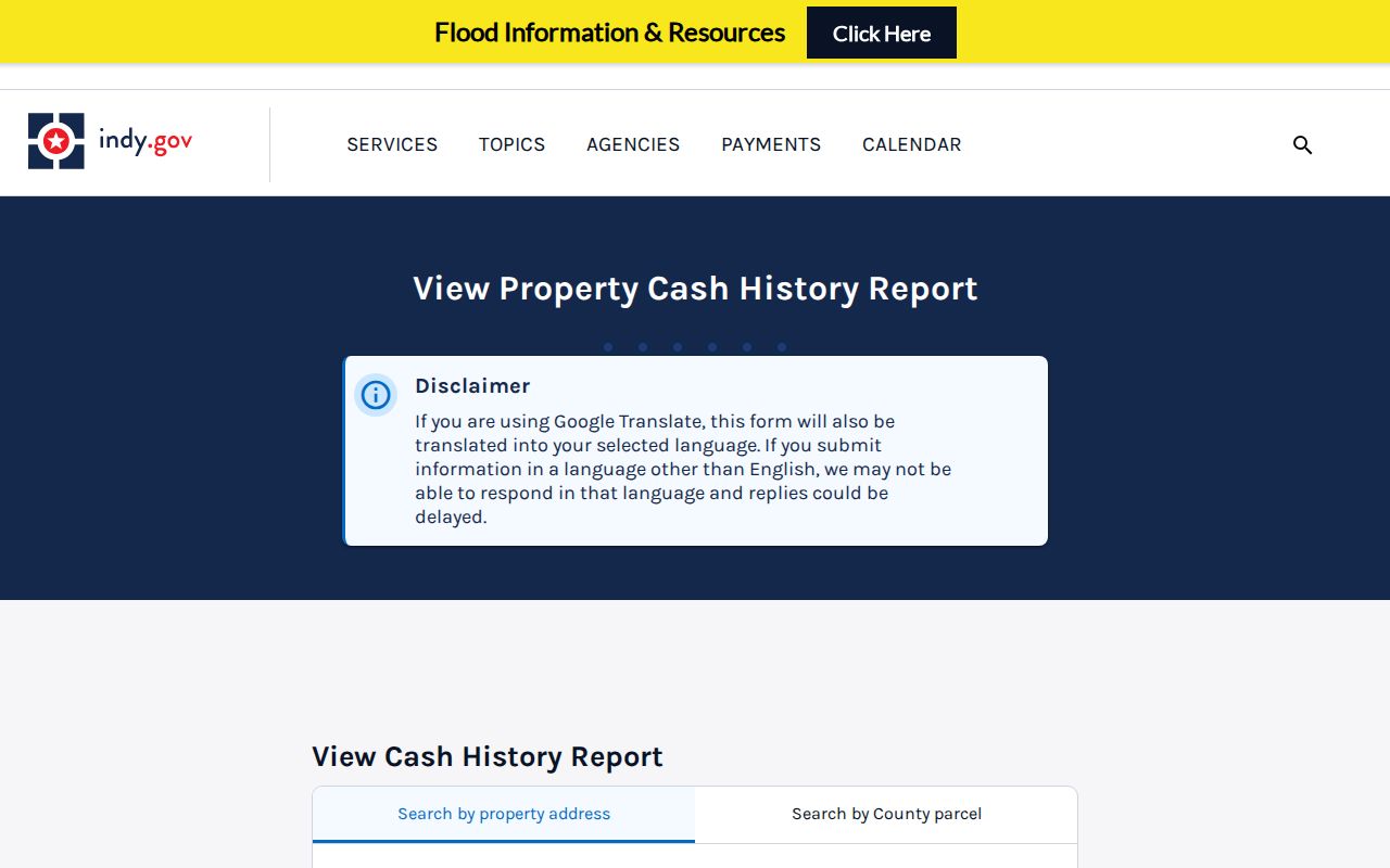
It is best read beside the assessor card, where the situs and legal description can confirm the account.
Search Lawrence Streets Under Old Names
Modern Lawrence labels do not reach the full record trail. The area was platted as Lanesville in 1849, renamed Lawrence in 1866, and later shaped by Fort Benjamin Harrison, rural routes, Unigov-era boundaries, and post-fort redevelopment. Search Lanesville, Lawrence Township, Fort Benjamin Harrison, Indianapolis, and the subdivision or legal description when a modern address fails.
Legal descriptions are especially useful when a number changes, a parcel splits, or a military or postal label disappears. MapIndy’s former legal limits, township, ZIP, neighborhood, parcel, and building layers may disagree because each describes a different geography. Record the layer and map date rather than forcing one label onto every era.
Read Lawrence Streets in Reverse
Haines criss-cross directories held by the Indiana State Library cover 1940–1979, while Polk and suburban runs supply other dated name and address views. Begin with the address section and copy every printed name exactly. Then check those names in the alphabetical section for spouse, occupation, employer, and alternate address details.
Repeat the check in nearby years and compare the street with Sanborn maps, plats, census records, and deed dates. A “removed” mark reflects a directory update, not a proven move date. Full collection history belongs on the Lawrence city directory page; the street use is to build a dated address sequence.
Limits of Lawrence Street Records
Property ownership is public, but ownership is not the same as residence. Renters and household members may be absent. Indiana’s individual voter portal is not a free street roster, bulk voter data has eligibility and use limits, and protected addresses may be withheld. Utility customer data and driver records should not be assumed public. A failed search can also reflect spelling, date coverage, unit handling, or an indexing gap.
Lawful use. Use Lawrence address records for personal, civic, property, or family research, never to stalk, harass, intimidate, or harm anyone.
A sound street directory labels every result by source and date. It also states “owner, occupancy not established” when that is all the record supports.